A quick tour of Northern Arizona
Day 1 – Travel Day to Phoenix, Arizona
Cody’s Aunt Kathy drove us to the airport early in the afternoon. Going through security was very smooth. We paid extra to select our seats, opting for an aisle seat this time, so that we could get up without disturbing anyone when we wanted to use the bathroom or stretch our legs (trying to avoid those DVTs!). To help pass the time, I worked on my presentations for work and watched a couple episodes of 3 Body Problem (Netflix series) with Cody. Five hours later, we were in Phoenix!
When we arrived, we picked up our rental car, a silver Toyota Corolla. Our initial impression of the city was that it looked a lot like Las Vegas – sunny, palm trees, red rocks, and lots of traffic. As we were driving out toward Flagstaff, we also saw hundreds of saguaro cacti dotting the landscape. After 2.5 hours of driving, we were tired and opted for the tried-and-true Panda Express for dinner. Our Airbnb was a small studio adjacent to the owner’s own home. It had everything we needed and ended up being a good central location for our explorations.
Day 2 – Sedona, Arizona
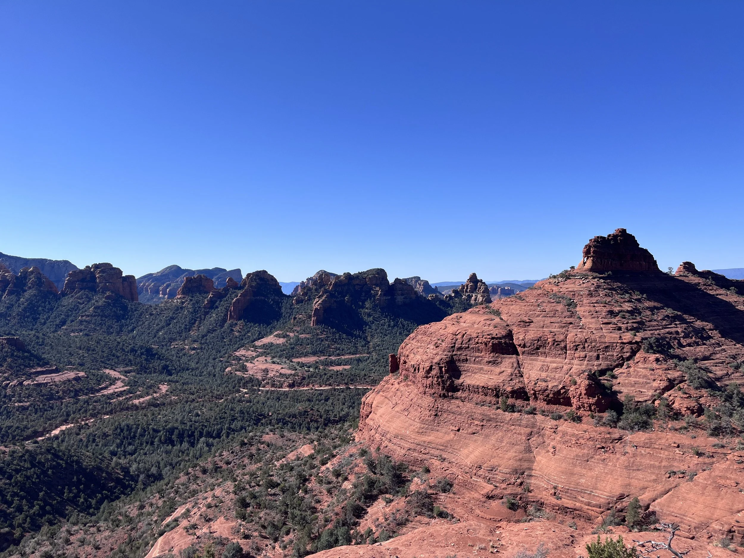
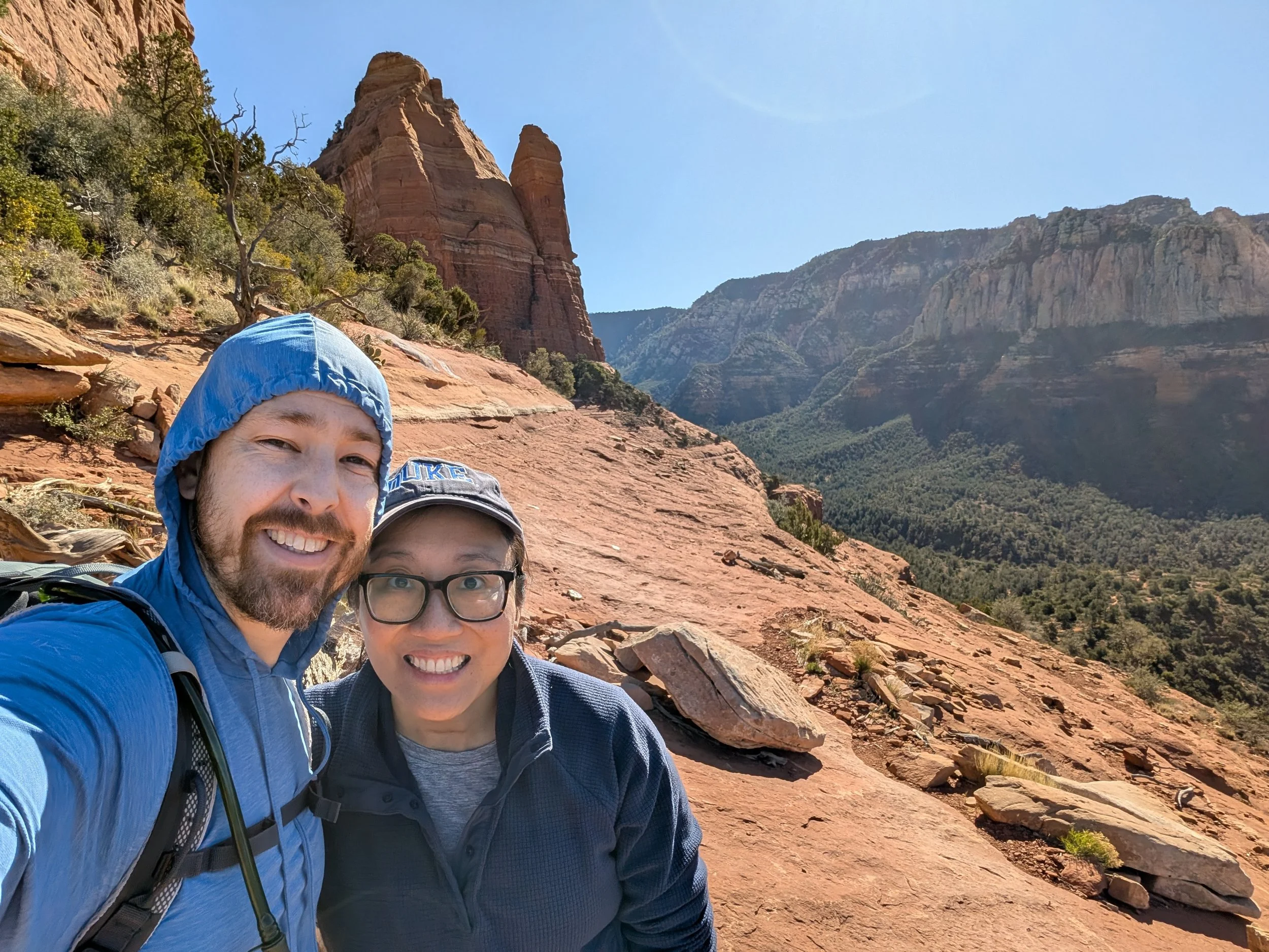
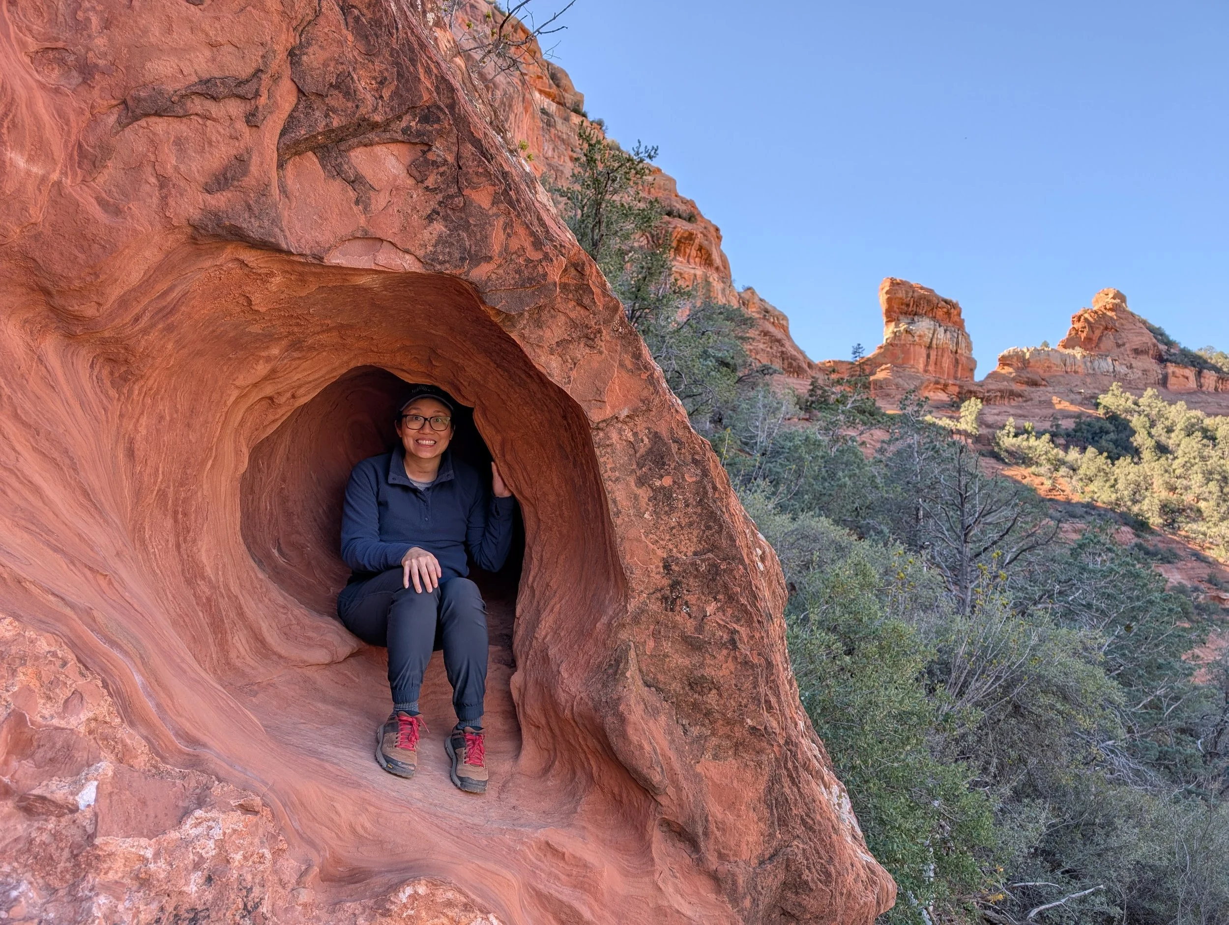
The drive from Flagstaff to Sedona is beautiful, especially as you wind through Oak Creek Canyon, surrounded by pine trees and towering tan and red rocks. It feels remote, and then you’re suddenly in the touristy downtown area of Sedona for a few blocks, before you go back into the canyon. Our hike for the day started a mile away from the city, an 8-mile loop connecting Munds Wagon Trail and Hangover Loop. For the first and last 2 miles of the hike, you can hear the rumbling of the nearby Jeep and helicopter tours. It gets a bit quieter once you reach Hangover Loop. We encountered a handful of other hikers (as we were resting, one exclaimed “What a beautiful day to just sit on a rock!” Agreed!), 3 mountain bikers, ants, flies and 2 lizards. We had amazing views overlooking the valley. It was interesting how starkly different the landscapes could be – red sandstone (slickrock) in one direction, grey limestone rocks dotted with pine trees in the other direction.

It was lunchtime when we finished our hike. As we searched for a restaurant, we realized that food in Sedona is expensive! We ended up choosing Dellepiane in the western part of the city. I had ropa vieja (meaning “dirty clothes” in Spanish, a Cuban dish of stewed shredded beef) and Cody had milanesa (an Argentinian fried steak). Growing up in South Florida, I might be a little more critical about ropa vieja than some, and it was a passable rendition of the dish. A nearby group asked me what I ordered and ended up getting it themselves.
Cody drove back to downtown Sedona, so that we could browse the small shops. The traffic was crazy! After a while, we were able to navigate to a parking space near a local church. We were not big fans of downtown, with the large crowds and shops selling Indian crafts and New Age “hippie shit” (Cody’s words, i.e. crystals, tarot, psychic readings, etc). Cody commented, “how can all these crystal shops stay in business?!” We later learned that Sedona is seen as a spiritual place to many, especially visiting the vortices, red sandstone formations, that are thought to promote spiritual wellness. “Charging” crystals, imbuing them with the vortices’ energy is a common practice.
For me, the highlight of downtown Sedona was finding the pressed penny machines. They had many of the traditional 51 cent hand crank machines, and I added two more to my collection. Unfortunately, we saw many parents crush the dreams of future pressed penny collectors, with them denying their children their spare change.
Day 3 – Grand Canyon National Park
We started the day by going to a nearby coffee shop, White Dove. It was in an unassuming strip mall, but had delicious lattes, tea and croissants. The drive from Flagstaff to the Grand Canyon South Rim entrance was about 1.5 hours. We parked at the visitor’s center and took the orange bus to the South Kaibab trailhead. Luckily, the bus system had transitioned to their springtime schedule a couple weeks ago, so they were conveniently circling around every 12 minutes.
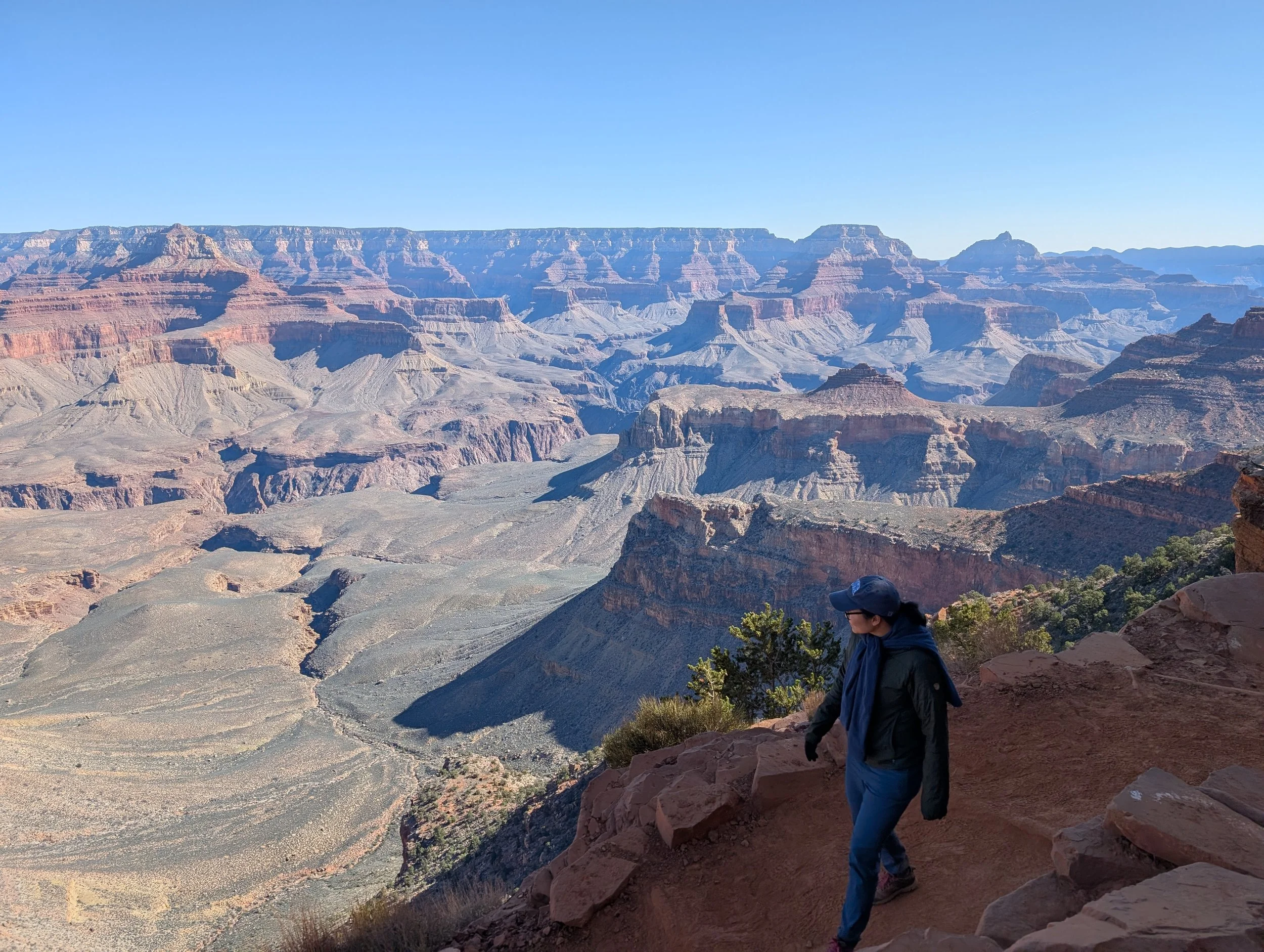
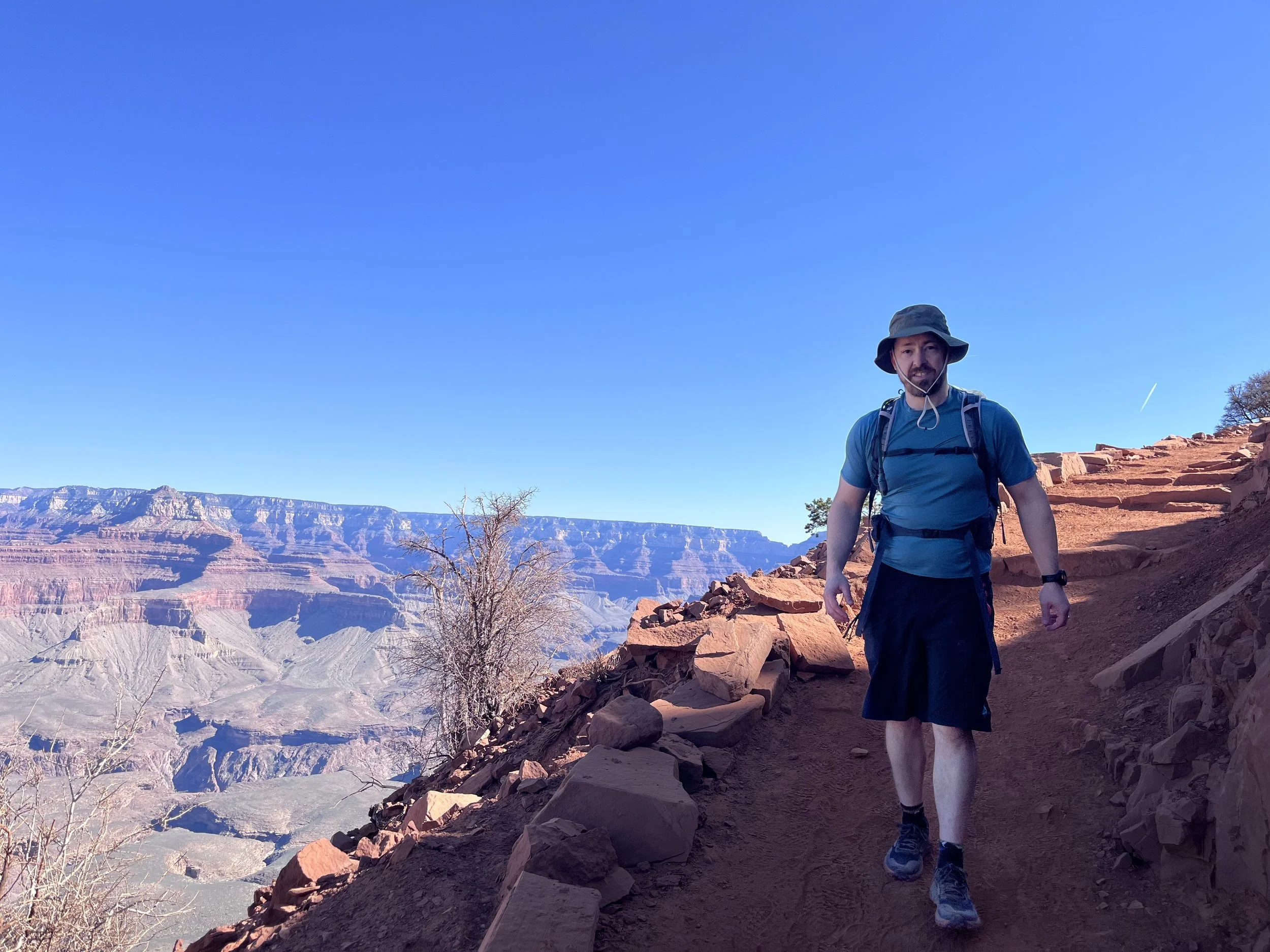
The hike is a popular out and back descent into the canyon. The trail is shared by mules, and we had the pleasure of seeing and smelling lots of mule feces at the start of our hike. We walked down about 1.5 miles and 1200 feet of elevation to Cedar Ridge, before turning back around.
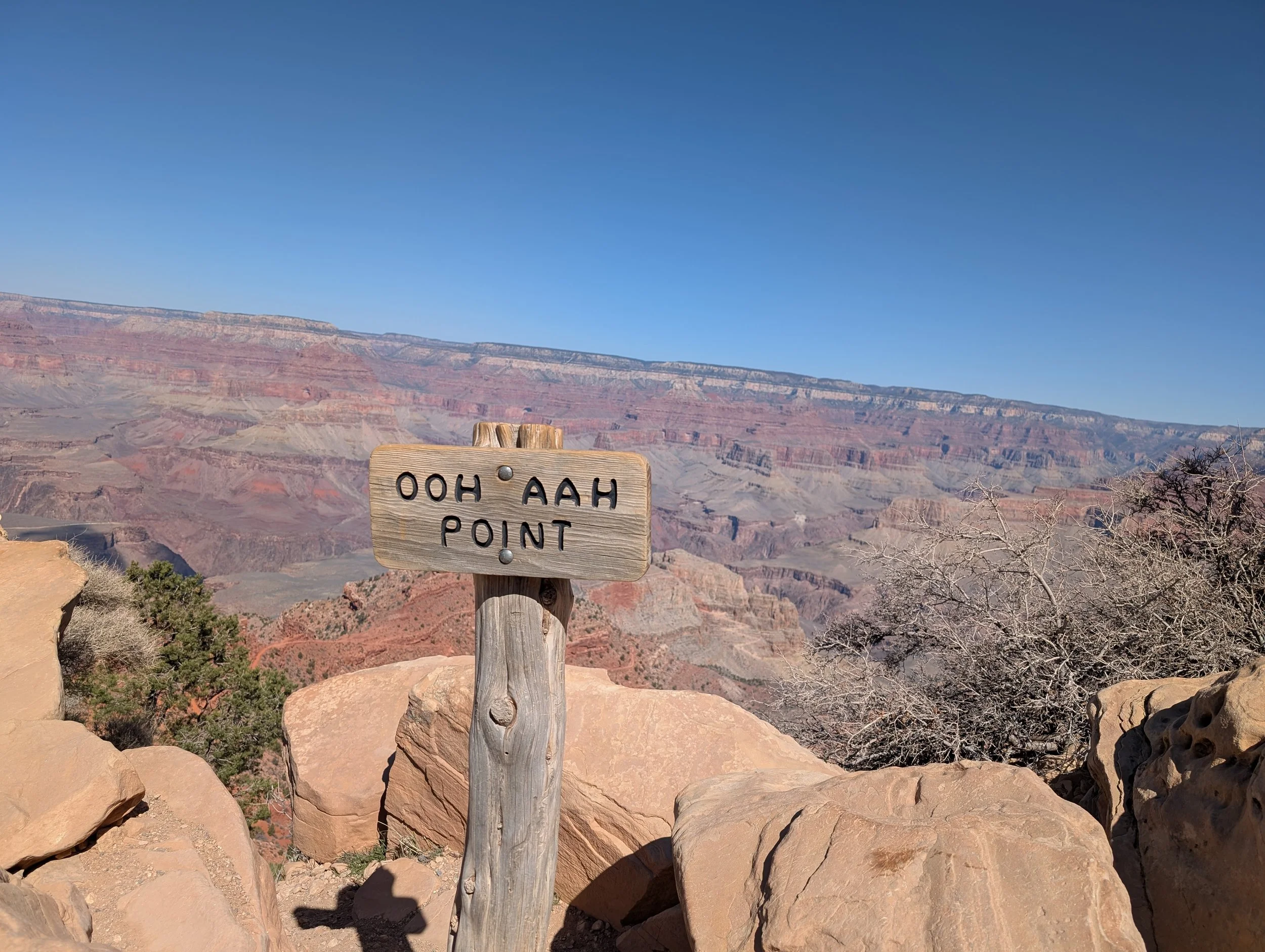
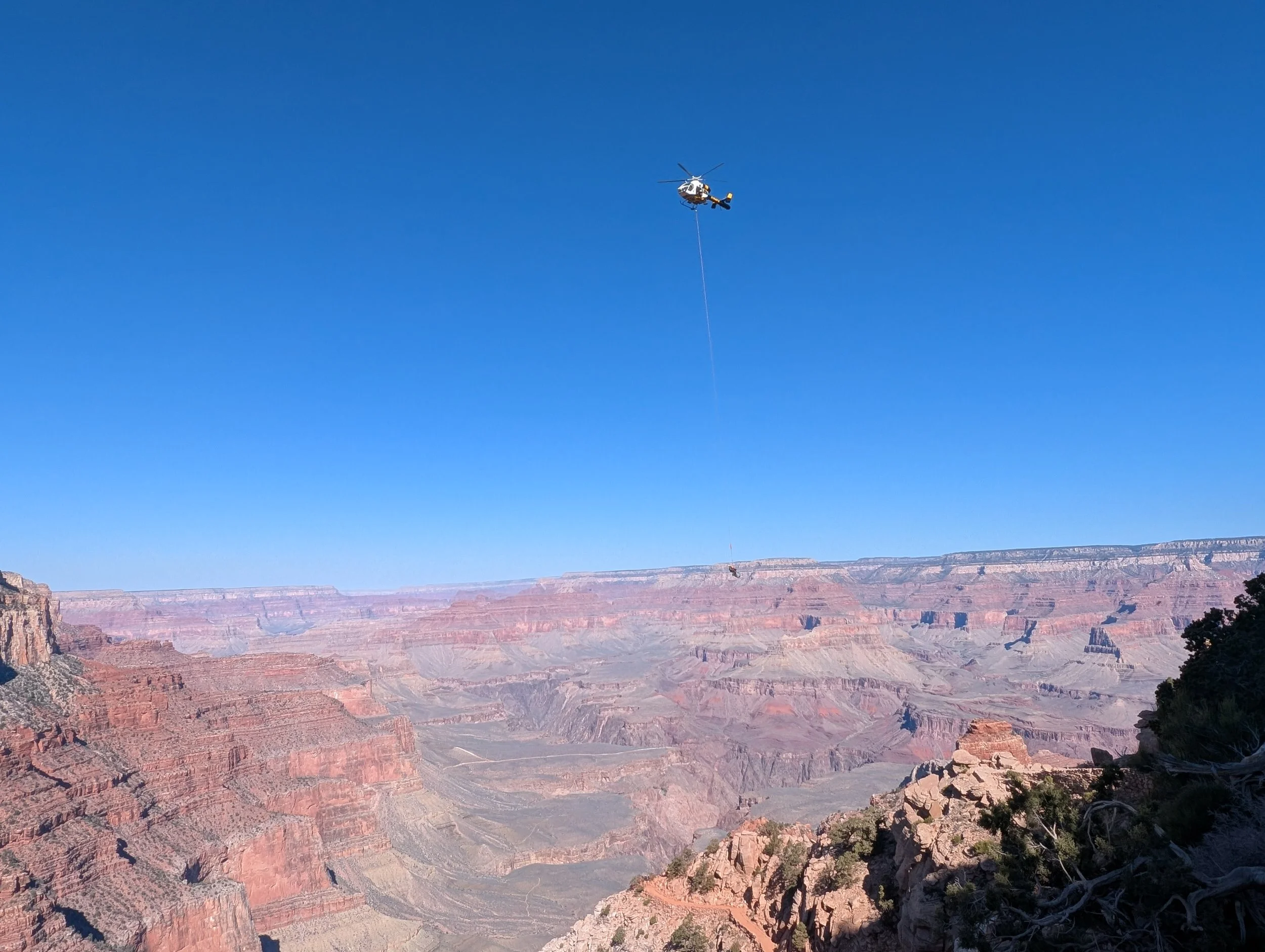
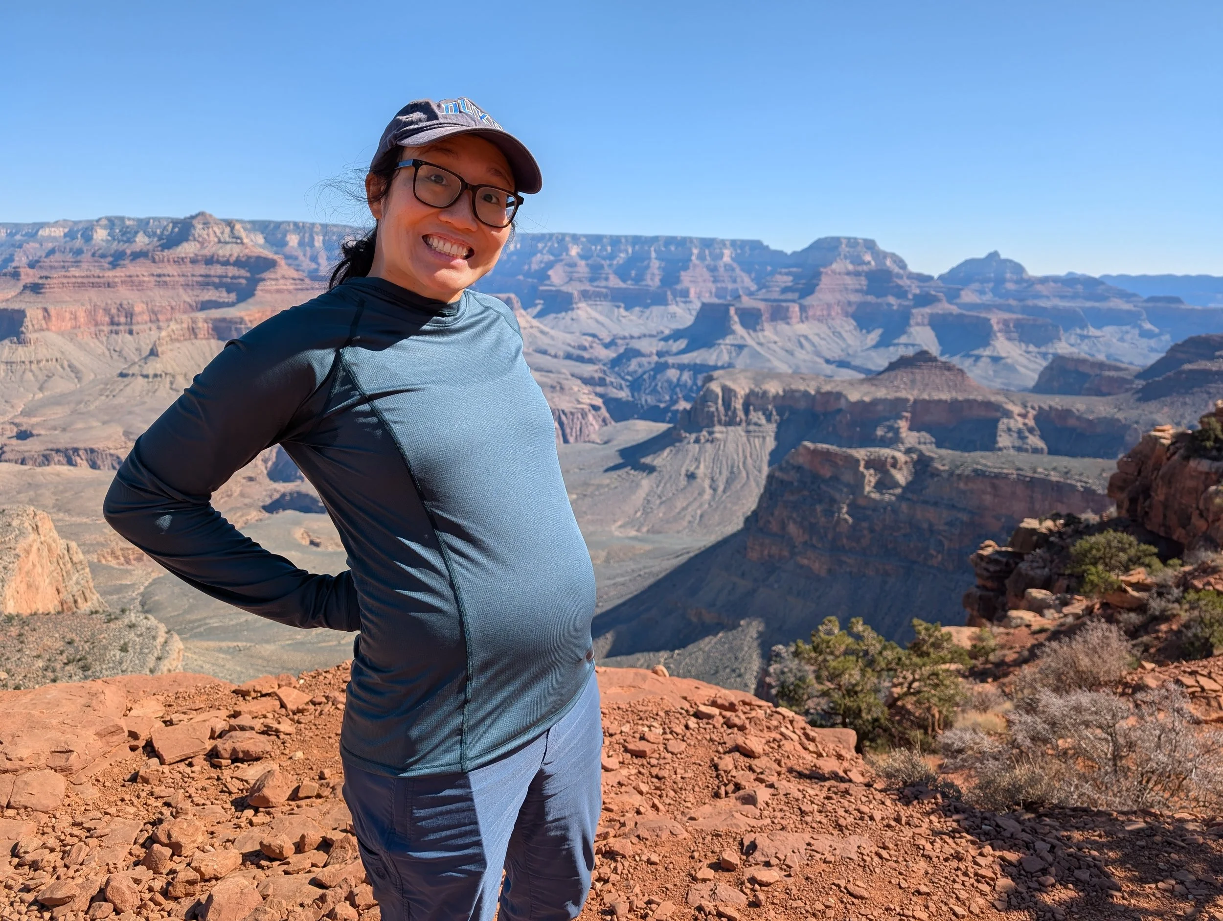
A constant refrain in the Grand Canyon is to remember your limitations; whatever you hike down, you also need to be able to hike back up. It’s easy to get into trouble, as the descent feels easy. The area also has touristy vibes, and we saw many people wearing sandals without carrying any water, so I can see how some people can get carried away. After a mile of hiking, you reach a scenic overlook called “Ooh Aah Point.” We were stopped shortly before this point, as there was an active rescue taking place. It felt surreal seeing the helicopter fly just a few feet away from us, lowering its rescue line to whisk the patient away, dangling in the air. I usually don’t get too emotional with medical-related things but found myself crying at the whole series of events.
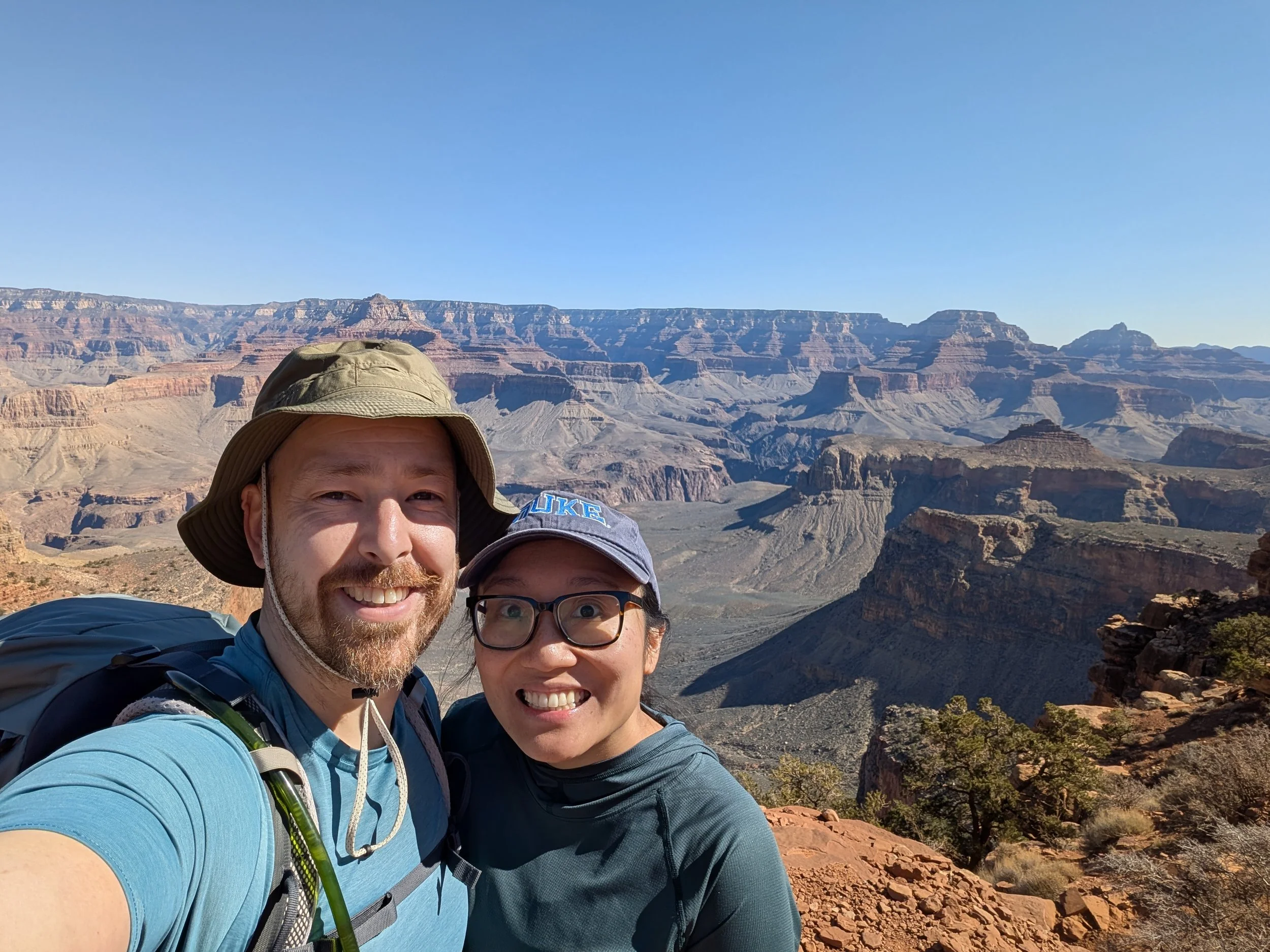
Once the area was cleared, we continued our hike down to Cedar Ridge. We had beautiful views of the canyon, while eating our snacks. Although remarkable, it was hard for me to capture the vastness of the Grand Canyon. From where we were sitting, you can’t see the entire 4800 feet down to the Colorado River, nor can you see the entire expanse of the canyon. One day, Cody and I aspire to go back, to make our way all the way down into the canyon, spend a night or two there, and make the arduous trek up again. After our hike, we took the bus to other parts of the park to eat lunch and find pressed pennies.
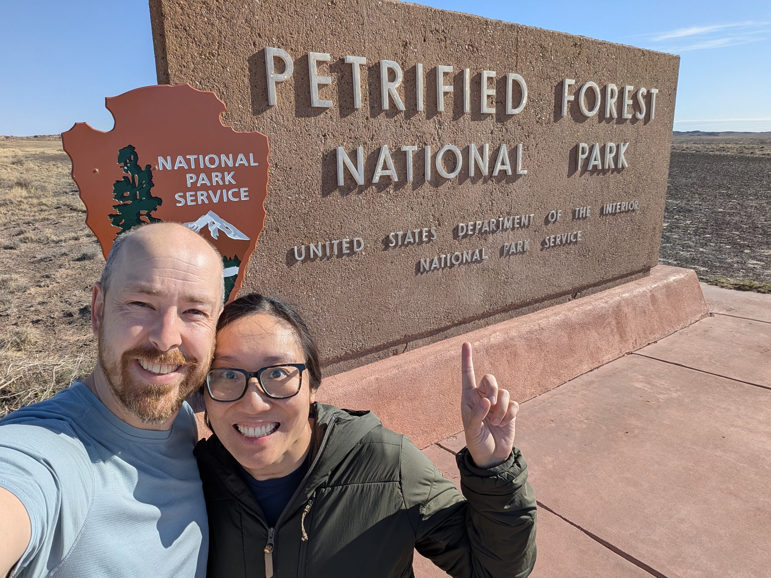
Day 4 – Petrified Forest National Park
Today we went to the Petrified Forest National Park. On the drive there, about 40 miles away from Flagstaff, Cody spotted a highway exit sign for the “Meteor Crater.” Cody exclaimed, “Is that the Barringer Crater?! We should go see it!” I am always impressed by Cody’s random knowledge (another instance of this was when we were in Acadia whale watching… his whale facts were remarkable!). I am fortunate that I can learn from him, and it sometimes leads to fun, unexpected side quests. We decided to save the visit to the Barringer Crater for the end of the day. The remainder of the drive was pretty flat and quiet. A random habit of ours is that we’re perfectly content driving in silence; no need to listen to music or podcasts every time.
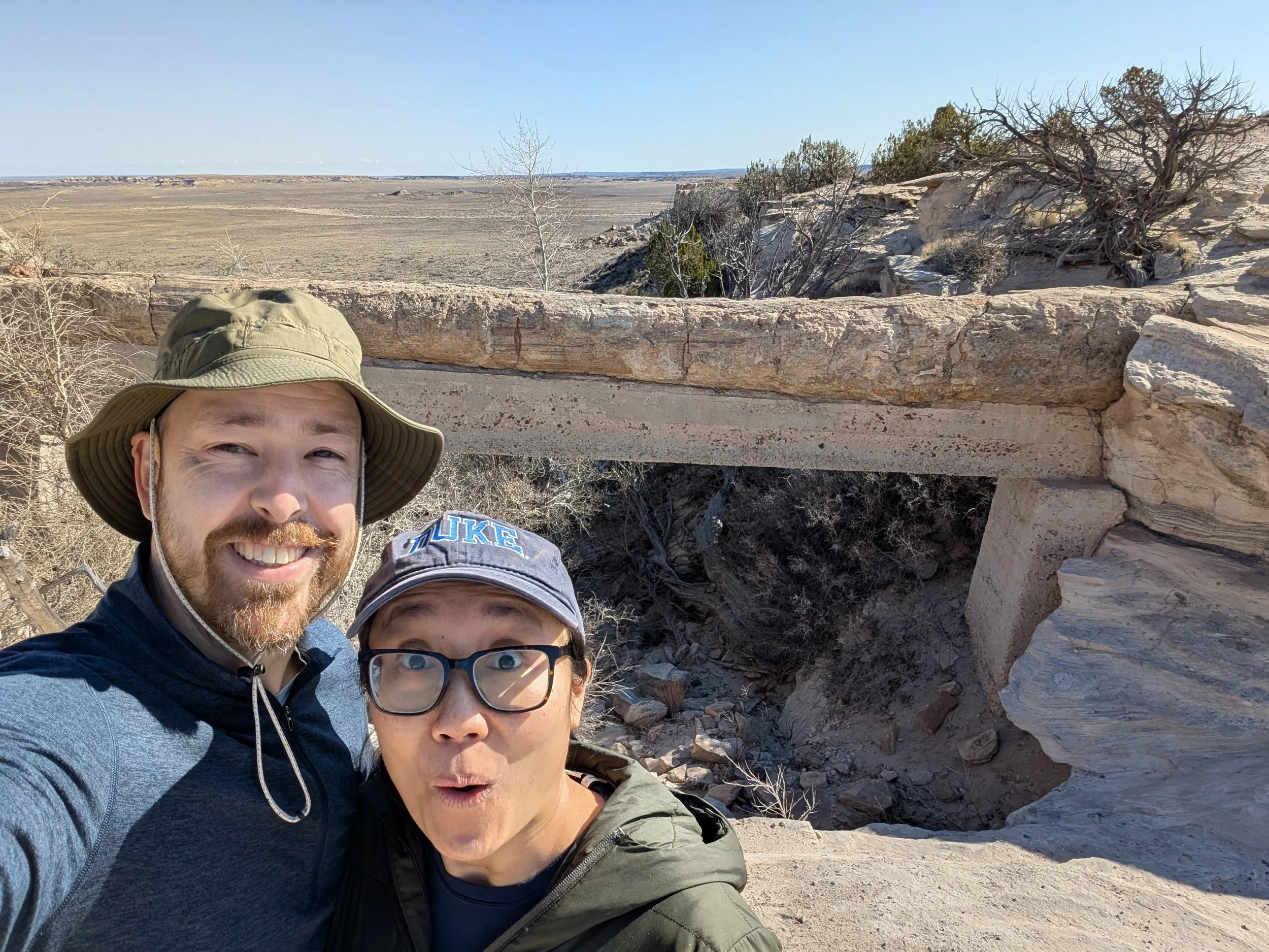
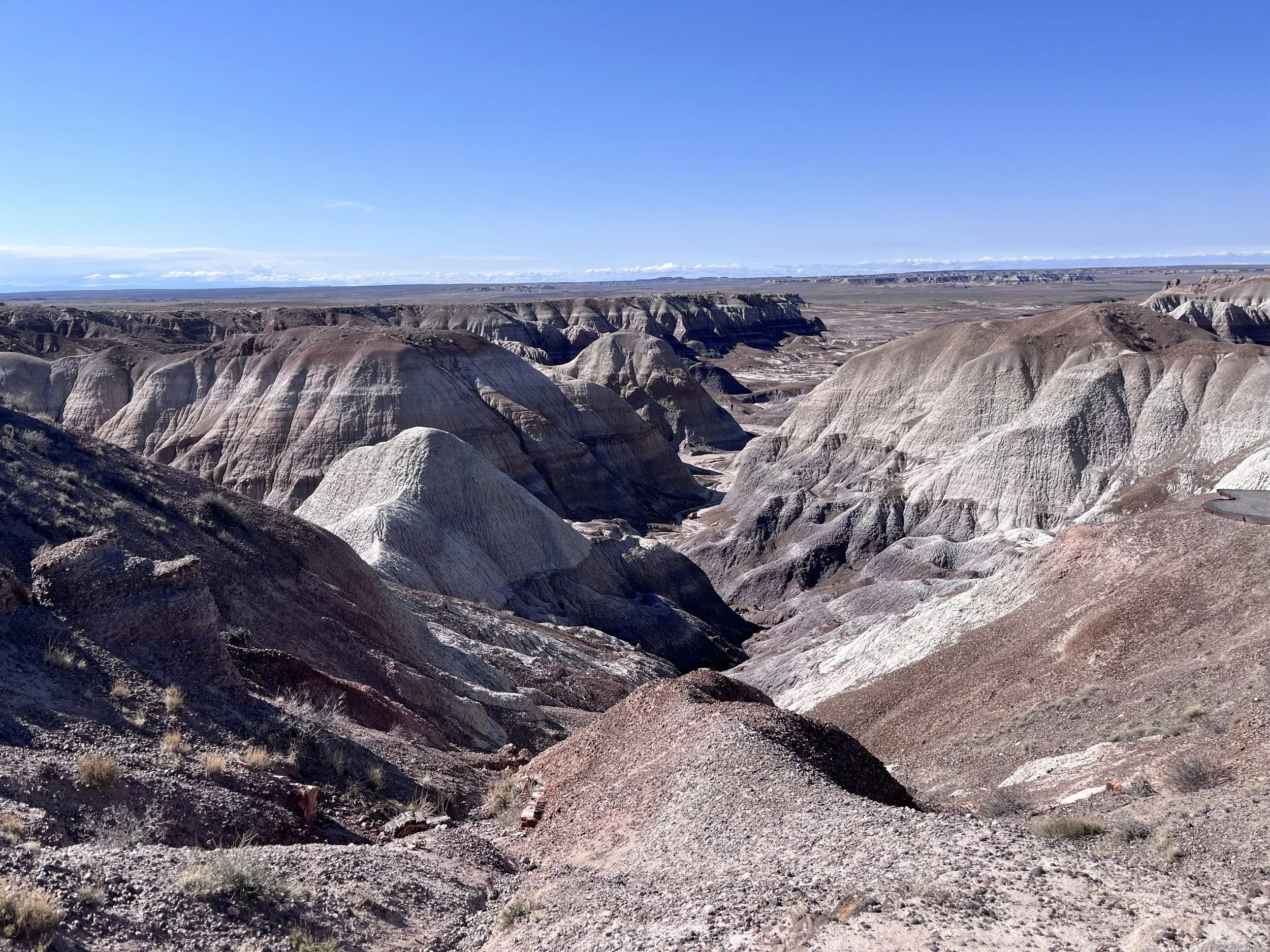
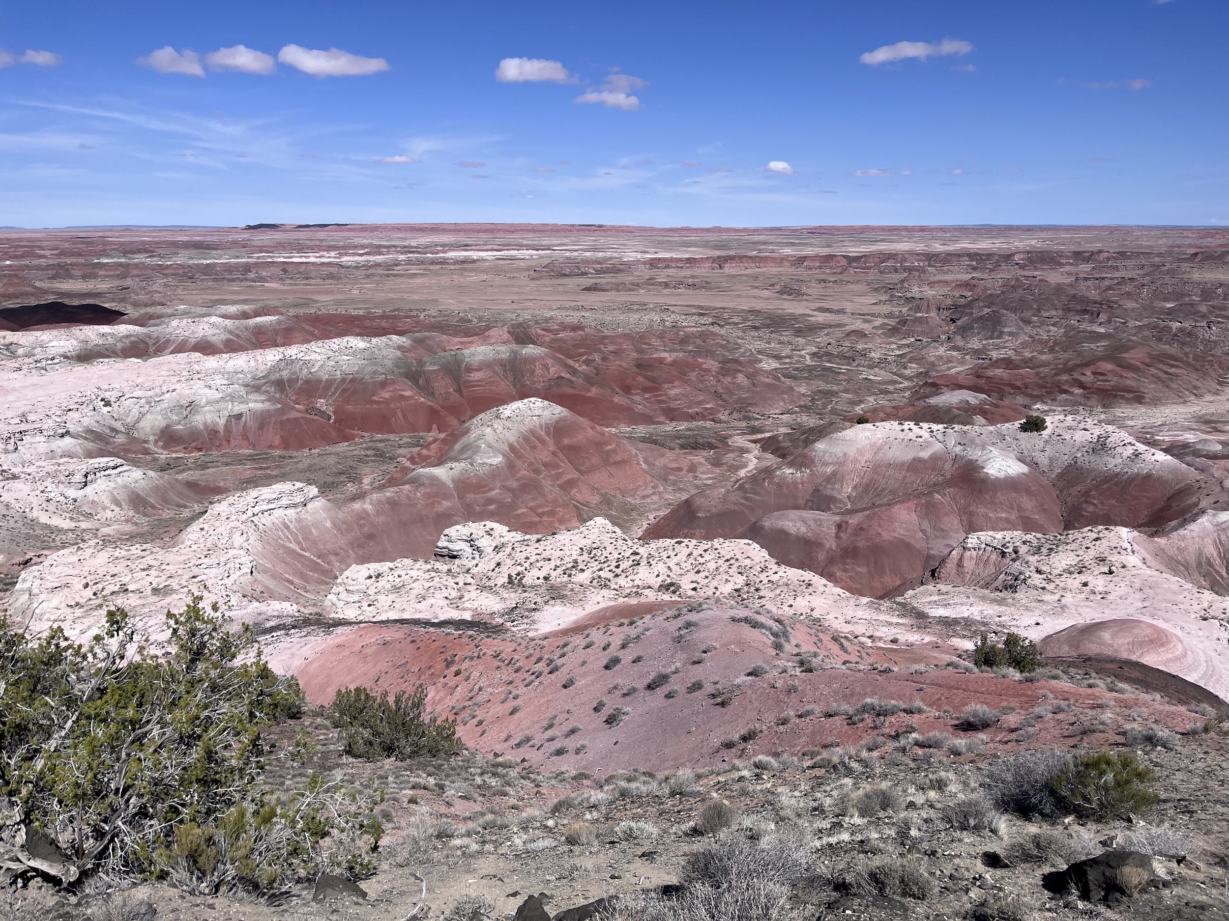
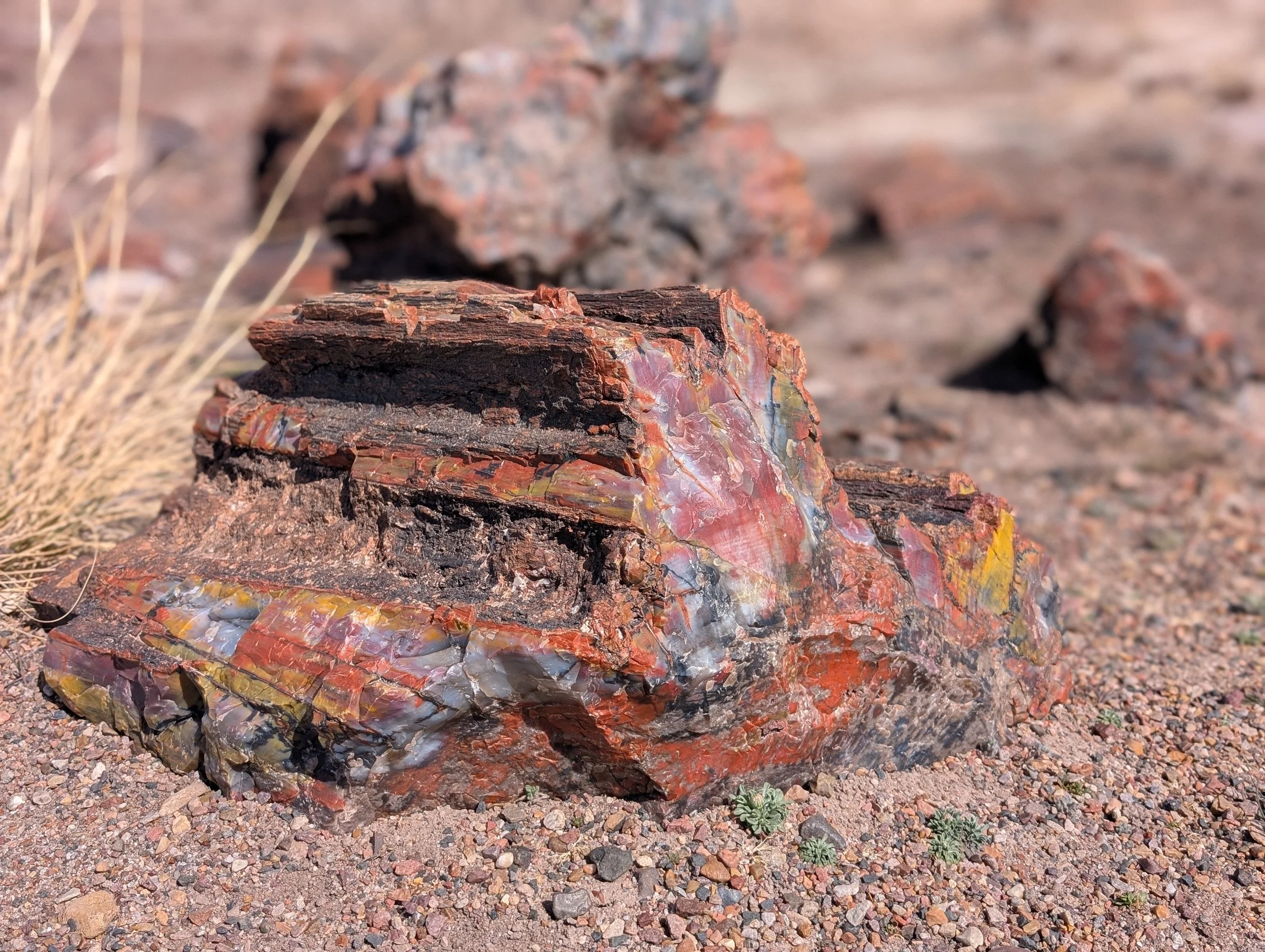
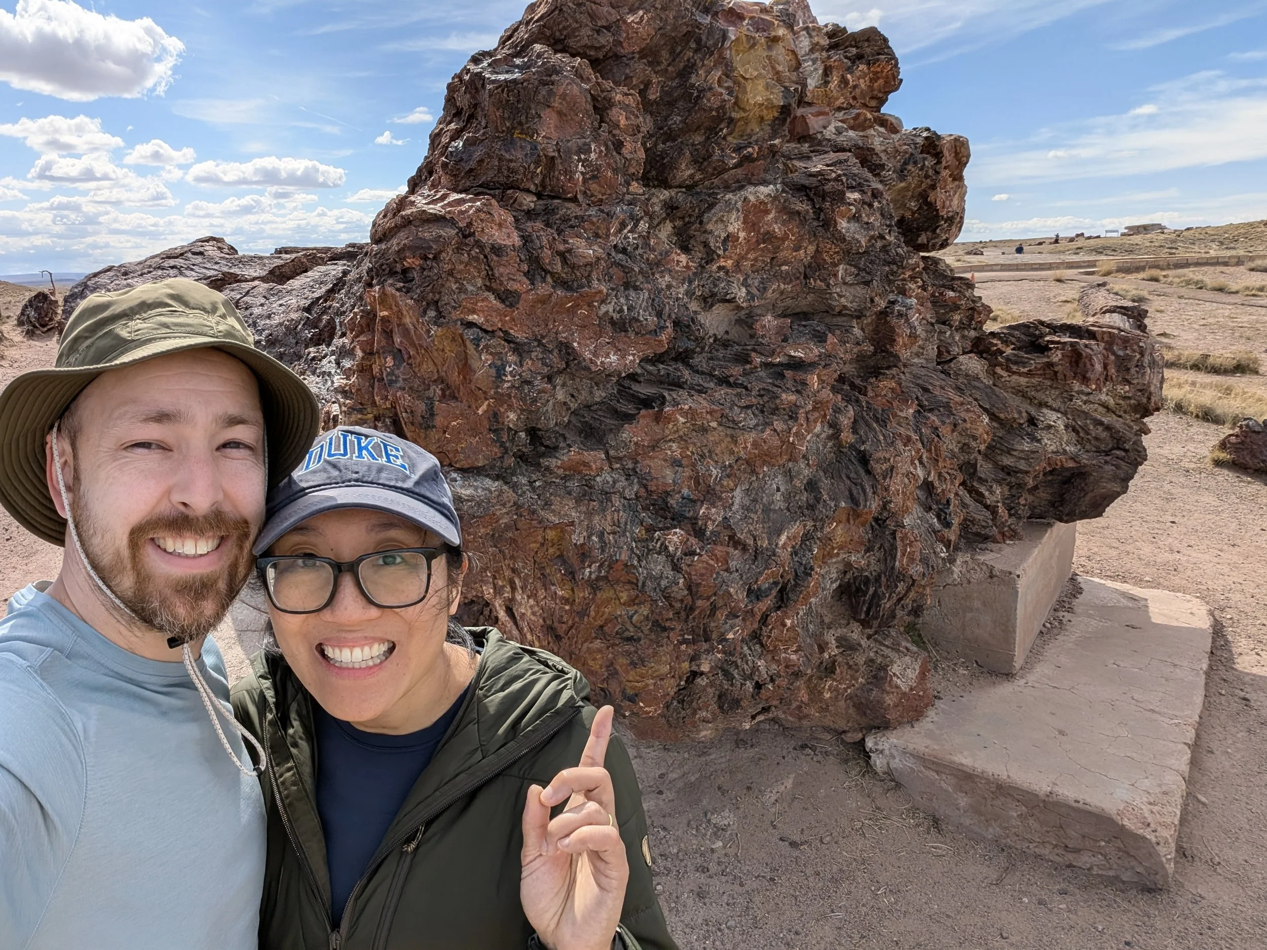
We entered the park at the south entrance, where most of the petrified wood is seen. It is 28 miles to the northern end of the park, where you encounter the Painted Desert, colorful eroded badlands. There are many stops along the way for scenic overlooks and short hikes (we did our stops out of order). First, we drove to the Agate Bridge. It was kind of a silly landmark to me. The conservation efforts of 1917 were not always environmentally friendly, nor aesthetically pleasing. It is a large petrified log that spans the Agate Mesa that is supported by a concrete base. Next, we went to the Blue Mesa, a short one-mile loop. It is an interesting walk among the badlands and hoodoos, in colorful bands of grey, blue and purple. We also stopped to see petroglyphs at Newspaper Rock and ruins at Puerco Pueblo. At the northern end of the park, we took a short walk on the Painted Pictures Rim Desert Trail with views of the colorful stratified rock layers.
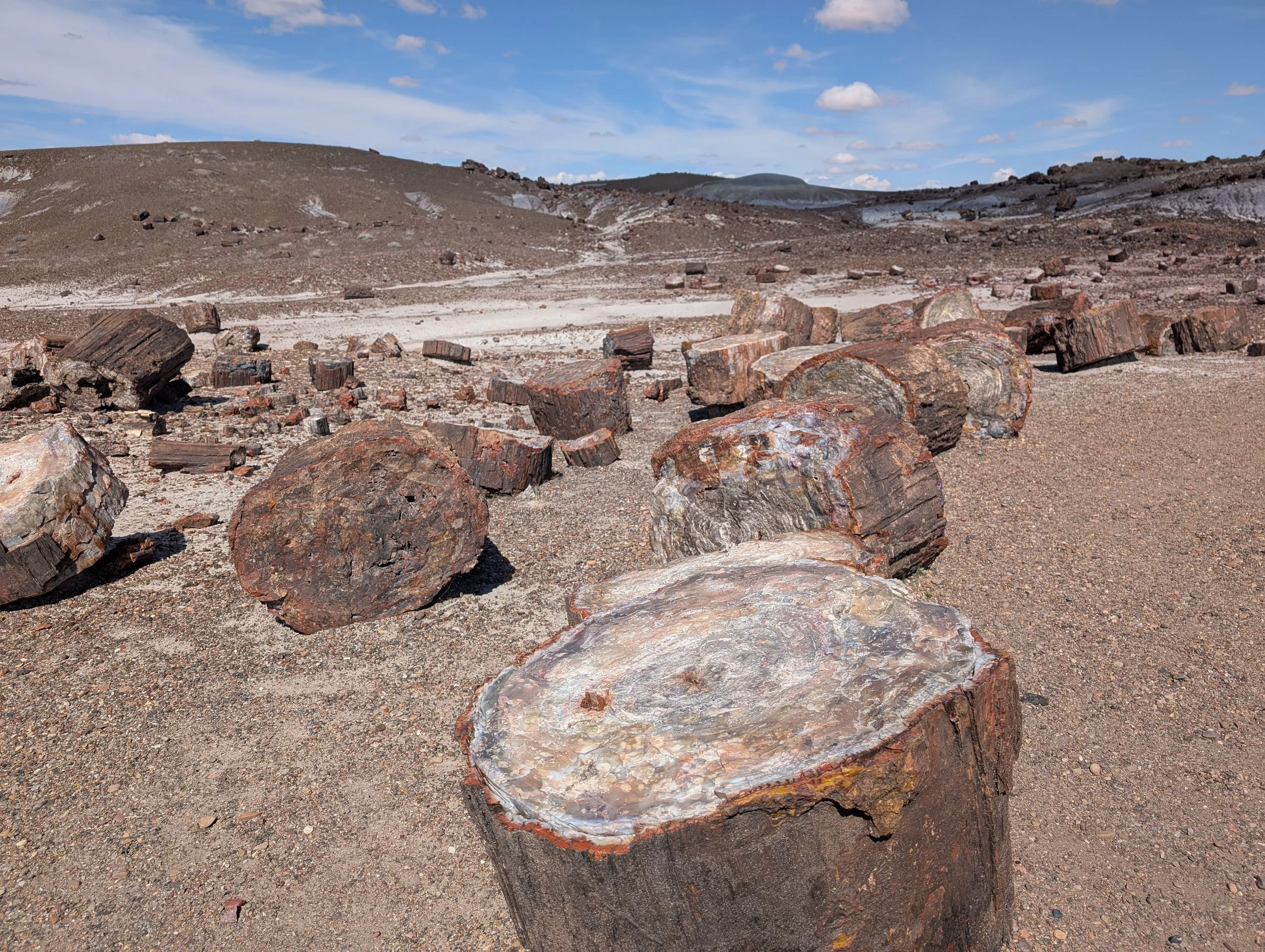
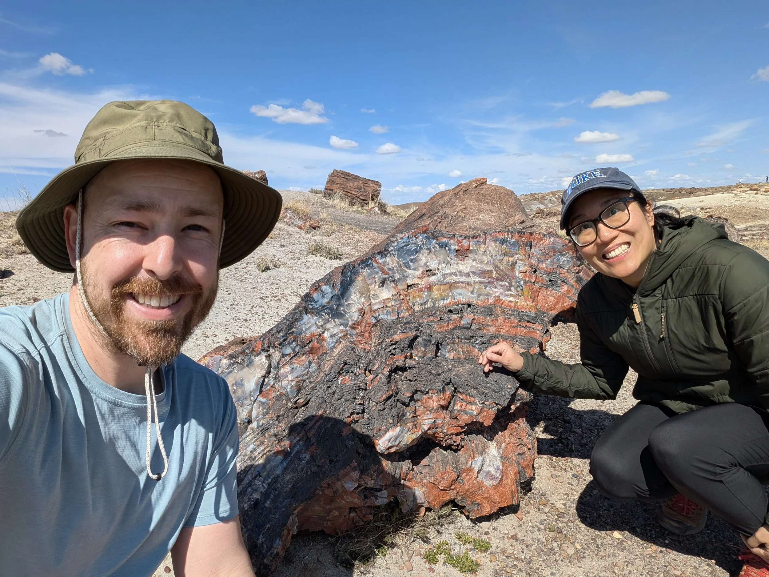
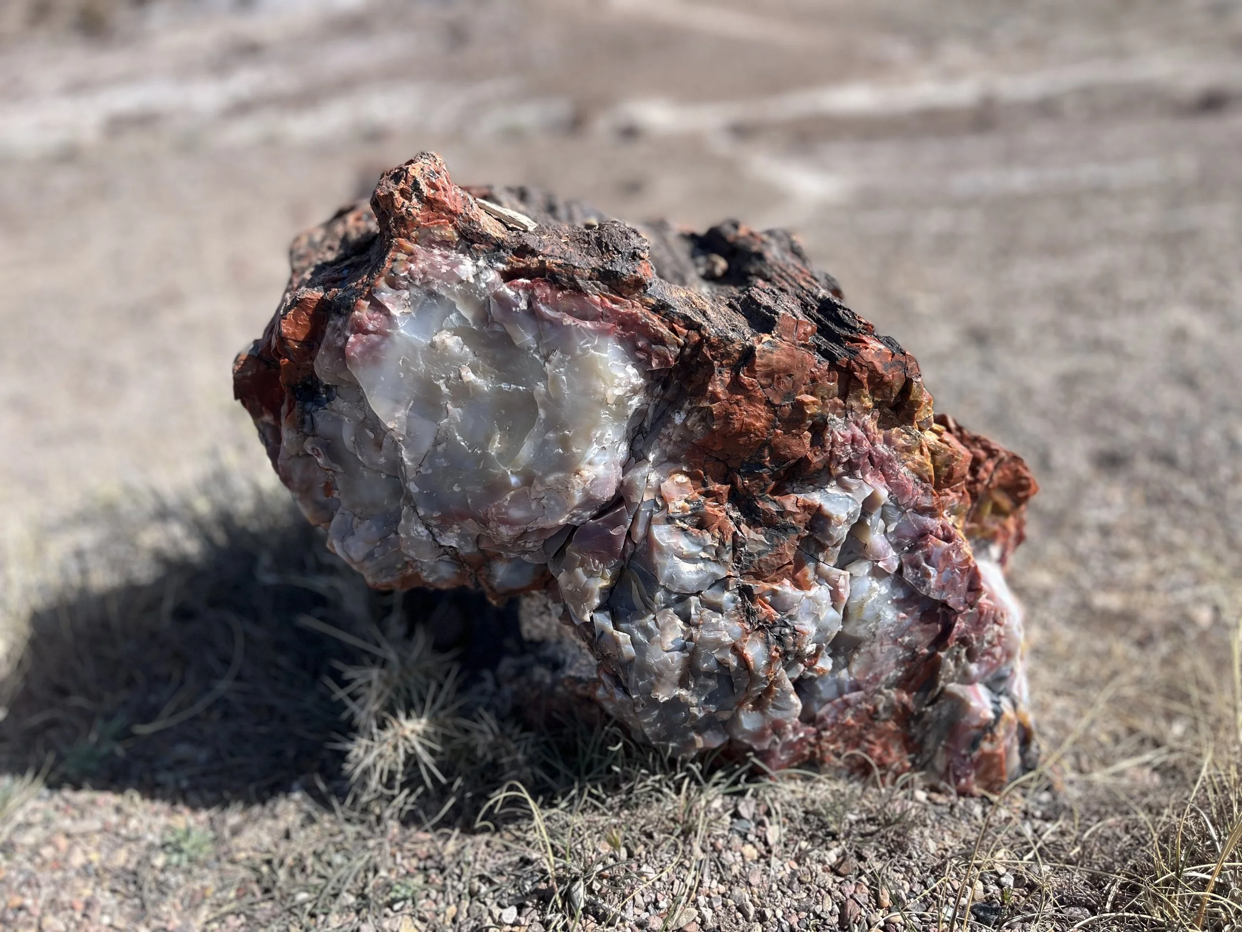
There are not many amenities in the park, so we were pleasantly surprised to see there was a Route 66 themed diner at the visitor center. Cody had a pulled pork sandwich, and I had a cup of chili. We shared some tater tots. We drove back toward the southern entrance of the park, taking short walks to see more of the petrified logs at Jasper Forest, Crystal Forest and Giant Logs trail (seeing “Old Faithful,” a giant petrified log that is 10 feet at its base, 35 feet long, weighing 44 tons). We skipped a few other stops, so we could make it in time to see the Meteor Crater before the museum closed for the day.
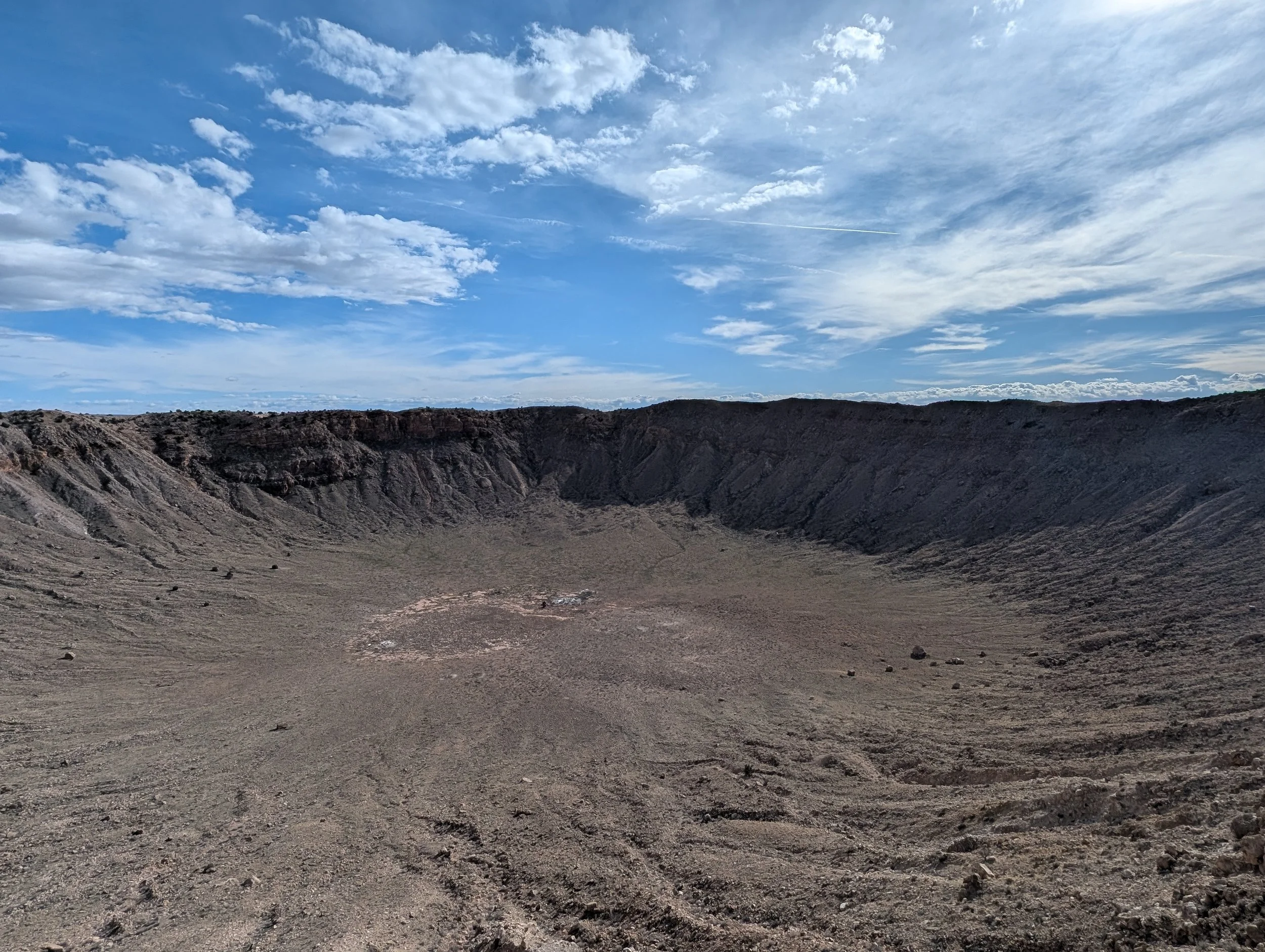
We made it to the museum to catch the last tour of the day. The Barringer Crater is the best preserved meteor site on earth. The crater was formed about 50,000 years ago, but it became of interest to American settlers in the 19th century. Daniel Barringer, who made his fortune in mining, was one of those people to take interest. It isn’t surprising that the origins of the crater were debated among scientists at the time, with many believing that the crater was a result of volcanic eruption, rather than a meteor impact. We learned that most of the mountains surrounding us in this region are actually volcanoes.
Barringer Crater
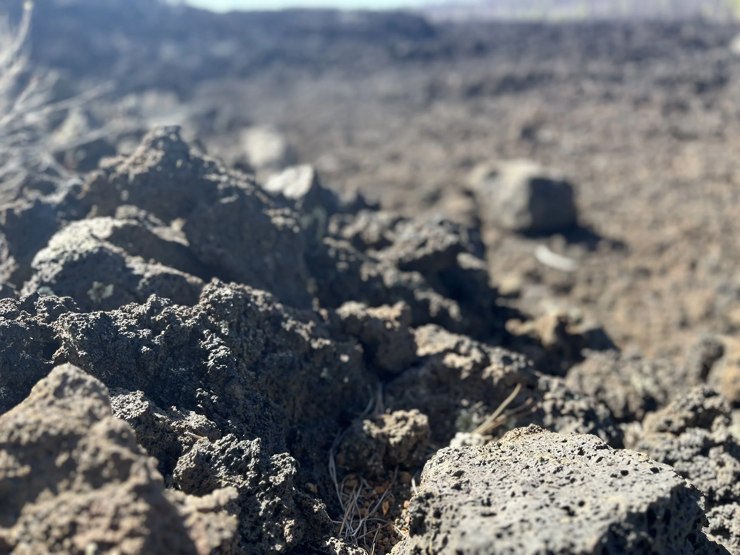
Barringer was one of the few that believed the crater was formed from a meteor impact. He spent over twenty years of his life and much of his fortune drilling into the crater, with hopes of finding meteoric iron to multiply his wealth. However, he never really found much, unaware that most of the meteor vaporized upon impact. Later, it was Eugene Shoemaker, who proved the crater was formed by a meteor, when he discovered rare forms of quartz shocked rock that can only be created by a significant impact event. As lay people, Cody and I noticed the rock surrounding the crater was bright white. In our limited experience visiting volcano fields, we are usually surrounded by black basalt rock.
When we are visiting a new town, we try to find a good local ice cream shop. We ended up at Timberline Ice Cream and shared scoops of vanilla and chocolate chip ice cream while sitting in the car. There wasn’t any seating in the shop, but it was delicious. We also ate dessert first, since the shop was closing earlier in the day. After dessert, we hopped across the street to have dinner at the Golden Dragon, crispy duck and vegetables.
Day 5 – Sunset Crater and Walnut Canyon National Monuments
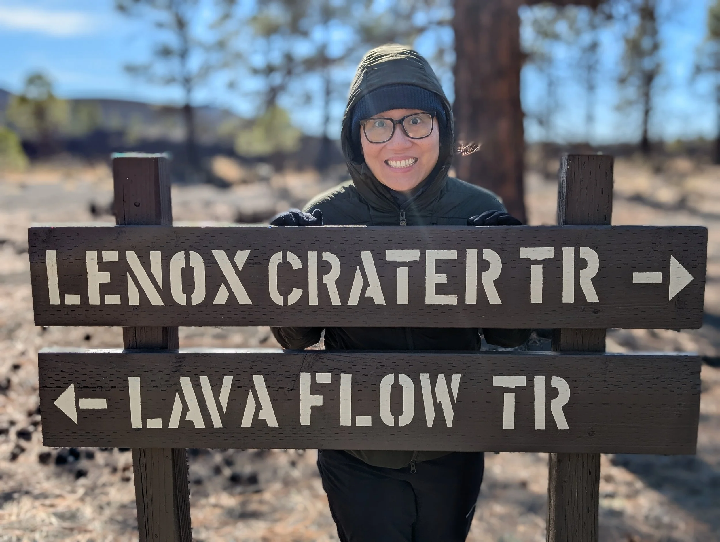
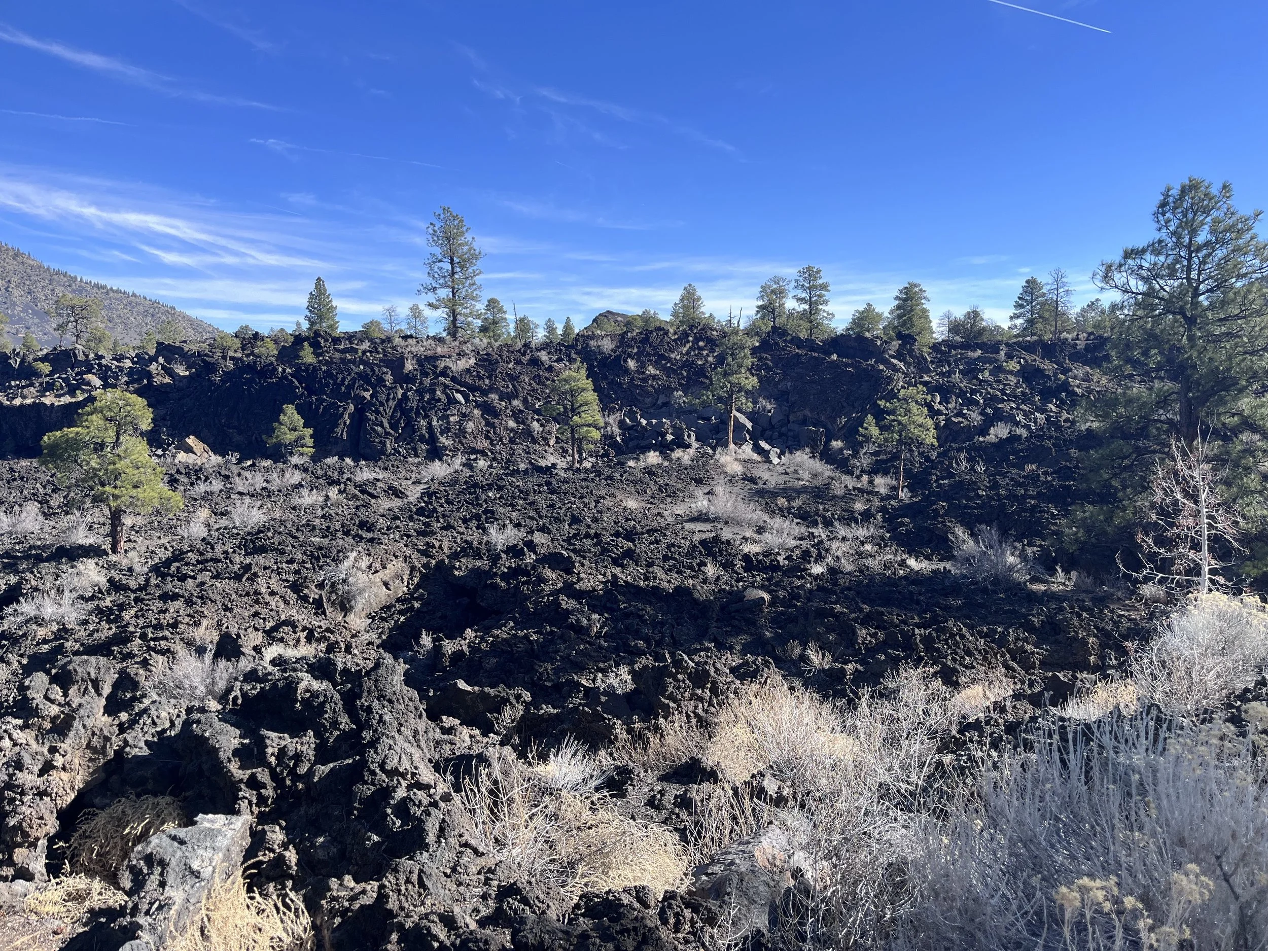
We did a lot during our short time in Arizona. Our flight wasn’t until later in the evening, so we had time to visit a few national monuments before heading to Phoenix. First, we went to Sunset Crater National Monument. We went on two short walks, the Lenox Crater and Lava Flow Trails. As noted above, in this area we were surrounded by volcanoes that are part of the San Francisco Volcanic Field. Fortunately, they are mostly dormant, however, eruptions are estimated to occur every 10,000 to 15,000 years. The last eruption happened here around 1085 AD. Despite the eruption occurring over 940 years ago, the destruction almost felt new, as we were surrounded by porous black basalt rock, burnt trees and smooth hardened lava flows. The burnt trees were from a more recent fire, but it added to the surroundings.
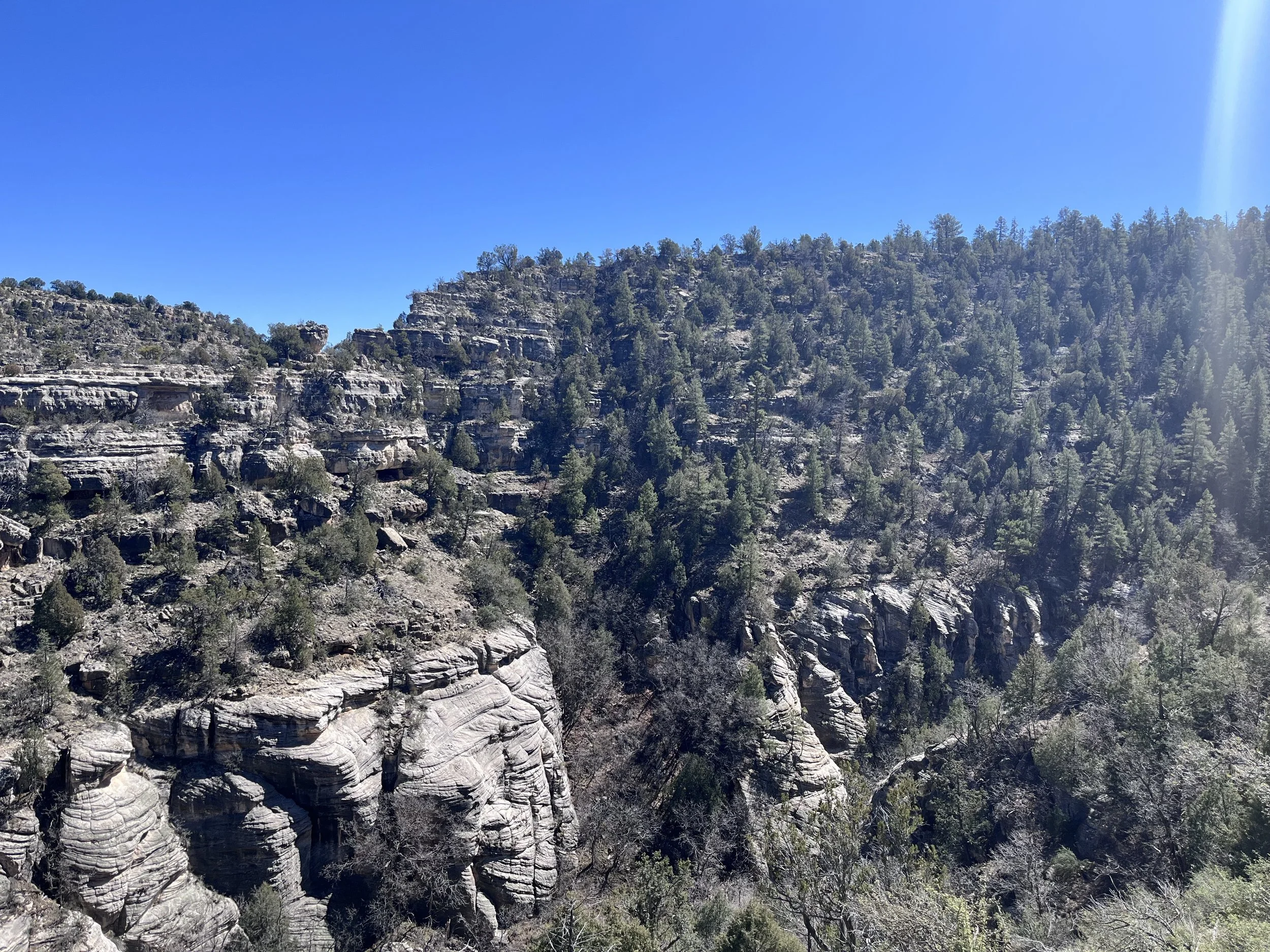
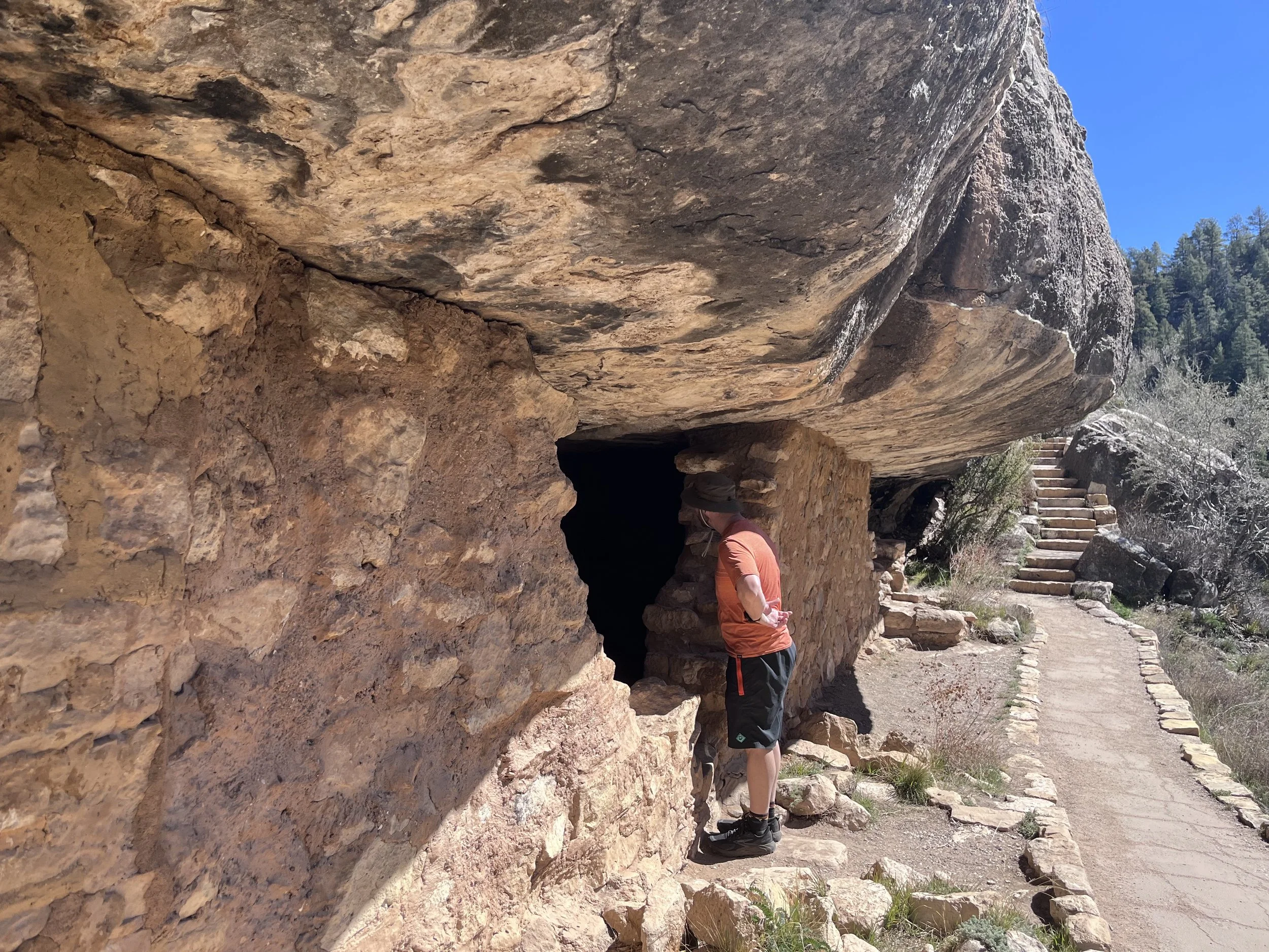
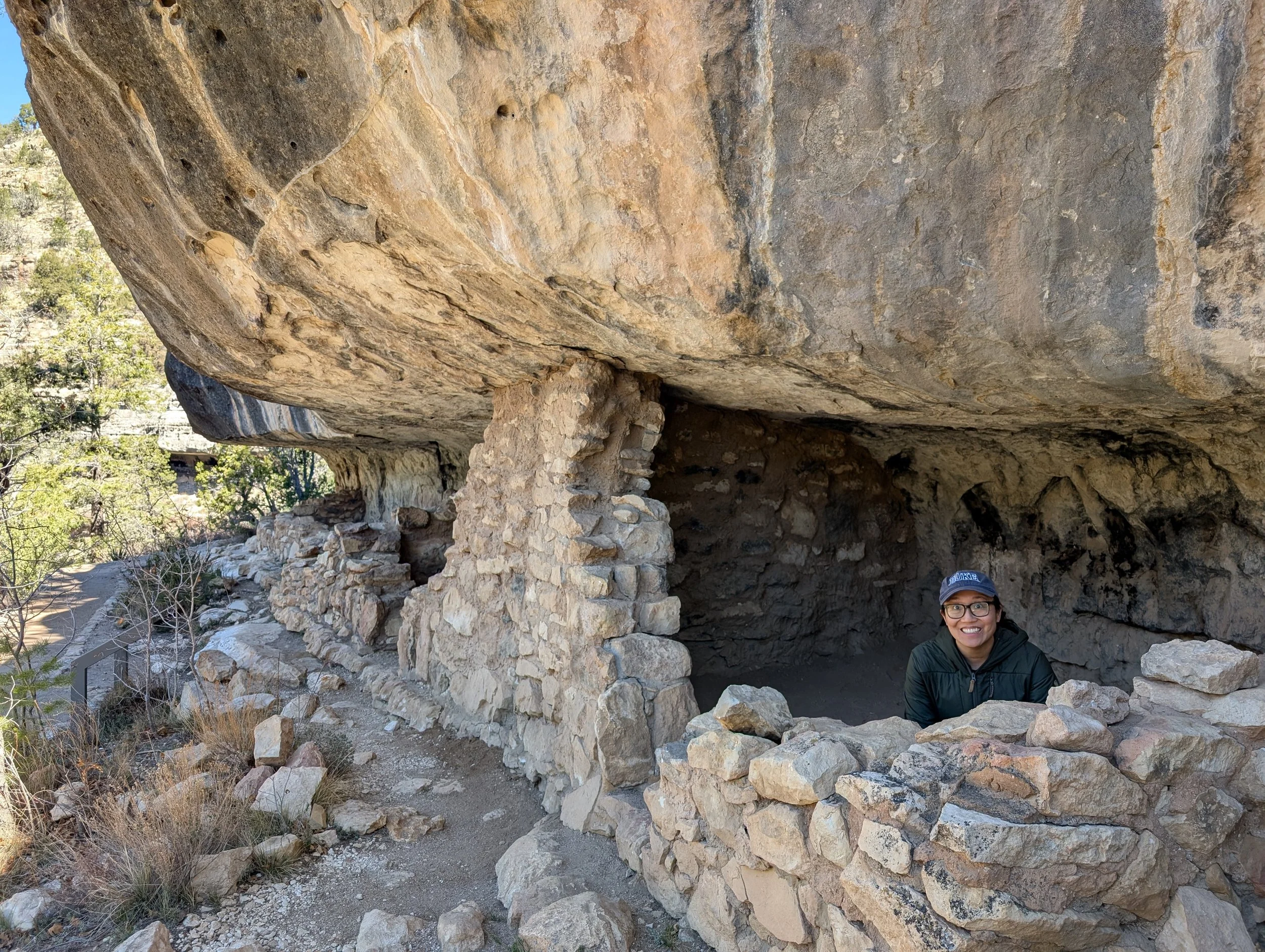
Walnut Canyon National Monument was a 20 minute drive south. There are two short trails that begin at the visitor center, and we had time to take the Island Trail, which was a 0.9 mile loop walking down into the canyon (185 feet, 240 paved steps) to see the cliff dwellings of the Sinagua people from the 1100s. From a distance, it was amazing to see small dwellings scattered throughout the canyon walls, hundreds of feet above the bottom. At the same time, on the trail, you can see a few dwellings up close and even walk into them. Singagua is Spanish for “without water,” and it’s interesting to imagine what life was like for them in such an arid landscape, climbing down the cliffs to raise animals and farm, and climbing up again to return home.
On our way to the airport, we stopped in Flagstaff to eat at the Cornish Pasty Co. restaurant for lunch. We were looking forward to trying something different and had never seen a traditional English restaurant before. Cody had the meat and cheese pasty, and I had their vegan vindaloo pasty. It was very tasty!
Summary
Cody and I saw a wide breadth of sites during our time here! We were a little bit disappointed about Sedona but can understand the appeal for others. I was proud of myself for hiking 8 miles on the Hangover Trail Loop. Cody had been trying to find longer hikes that we might not be able to do for a while in the future. This one was the perfect challenge level for pregnant me; Cody chose well! The Grand Canyon was also very touristy, especially since we did one of the more popular hikes in the area. One day, Cody hopes to return so we can make our way all the way down to the canyon floor.
We find ourselves comparing the sites to other places we’ve been in the past. We are always appreciative, but some of the “wow” factor has disappeared. We’ve stopped taking pictures every 10 feet on our hikes, opting to quietly enjoy our time outside. It is really fun to have a wonderful partner to experience these trips with.
Right now, we are excited (and apprehensive) for the next chapter in our lives. I would say we are in the “anti-nesting” phase at the moment. We have a couple other trips planned, including road trips to Tennessee and Virginia, Smoky Mountain National Park, visiting some of the parks in South Dakota, and a family trip to Niagara Falls. Some other goals will have to be on hold for quite a while (hiking hut-to-hut in the White Mountains and backpacking Tour du Mont Blanc). We are fortunate to have the time, financial resources and good health to go on these trips. I sometimes worry if we should be saving more. Luckily, our hobby of walking around in the woods is pretty affordable! We also minimize our trip costs by staying at modest lodgings (sometimes a tent!) and cooking many of our meals. I am frequently reminded by my patients that our health is not guaranteed. I feel heartbroken whenever I hear about their plans to travel in retirement that were thwarted due to an unexpected health diagnosis for themselves or their partner. We try not to take the blessings in our life for granted.